Pricing
NZD pricing is available to New Zealand individuals and organisations only. Prices exclude GST.
Free User
For anyone finding, viewing, and exporting open data.
- Single user
- Find, preview and export data
- Sign in to any site on the Koordinates platform
- Koordinates Public Data Catalog Info
AI Pro User
For individual professionals exploring geospatial data and making maps via AI chat.
Includes everything from Free User, plus
- KxAI Map Analyst Info
- MCP connection and MCP App
- Upload private or public data - 1GB vector, 6GB raster+point cloud
Data packs

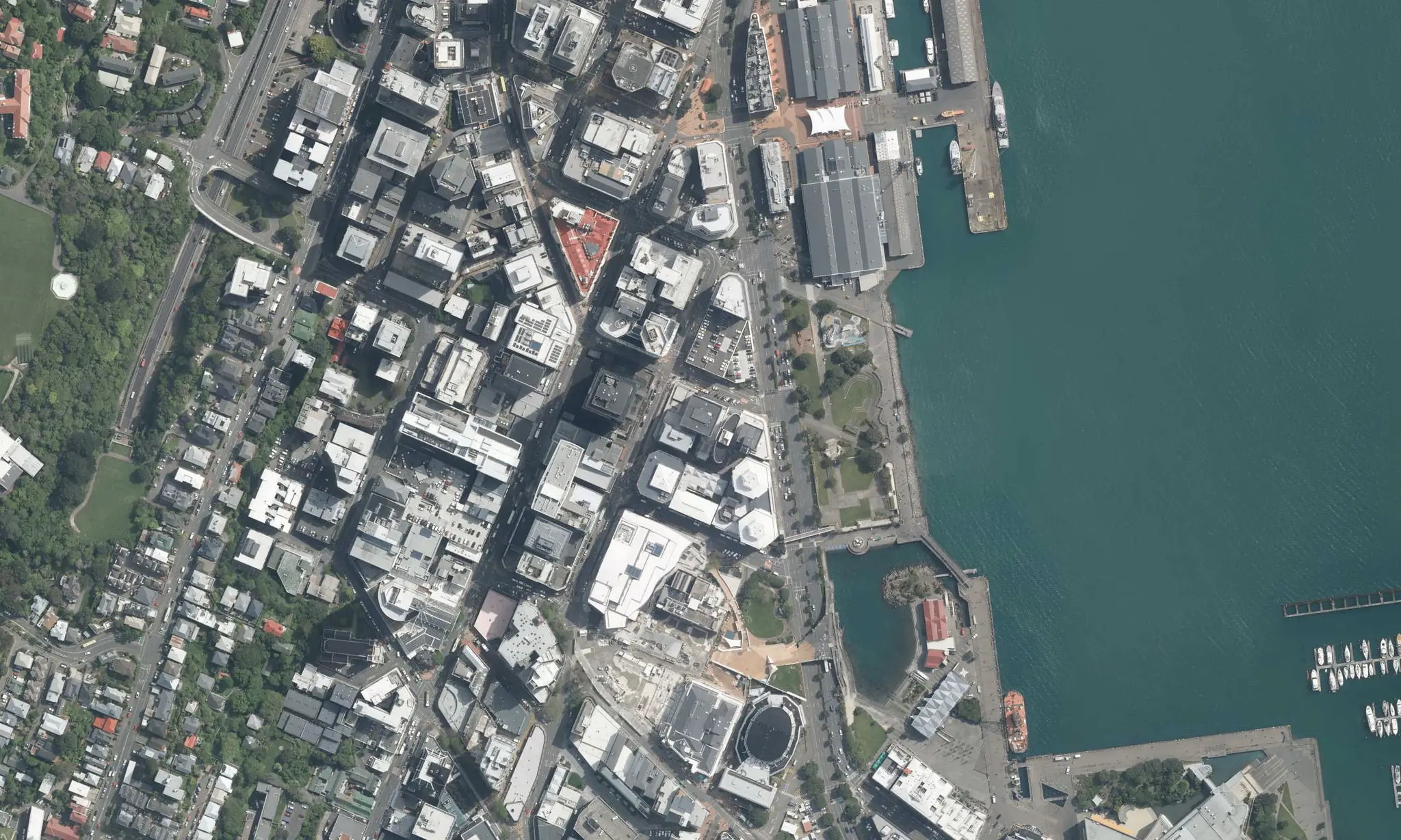
Koordinates Public Data Catalog
Included with AI Pro
8,000 datasets controlled and curated by their publishers.
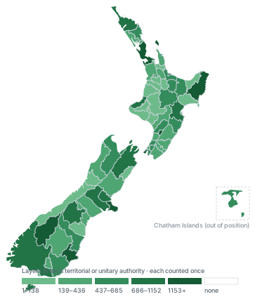
NZ Data Index
LabsIncluded with AI Pro during Labs phase
An index of public New Zealand Esri REST services.
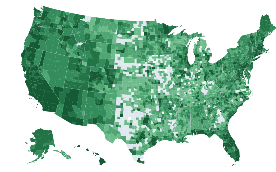
US Data Index
LabsIncluded with AI Pro during Labs phase
An index of over 950k layers from Esri services across America.
Confirm
Team Cloud Plan
For teams and small companies publishing and sharing data, or in the app development phase.
Includes everything from Free User, plus
- KxAI Map Analyst 200 AI credits per seat, pooled. MCP seats available. Info
- 2 paid seats, then $38 each
- 4 GB vector, 50 GB raster+point cloud, 100 GB map product
- Branded public site
Business Cloud Plan
For growing companies needing stronger branding, higher included usage, and services at scale for production apps.
Includes everything from Team Cloud Plan, plus
- 5 paid seats, then $50 each
- 20 GB vector, 800 GB raster+point cloud, 1 TB map product
- Custom domain and sandbox site
Enterprise
For large companies needing usage reporting, SSO, SLAs and enterprise-scale usage.
Includes everything from Business Cloud Plan, plus
- 20 paid seats, then $64 each
- 50 GB vector, 2 TB raster+point cloud, 4 TB map product
- Entra ID and Okta, SLAs
- Credits by agreement
NZ Government Sector
For public sector agencies, councils, and other organisations procuring through the New Zealand Government Marketplace.
- Agency-wide seats
- Enterprise storage and usage levels
- Entra ID and Okta, SLAs
- Data residency and reporting
- Koordinates Public Data Catalog Info
Work out your price
For Team Cloud Plan and Business Cloud Plan. Subscription gets the annual discount; overage never does, so the two are shown separately.
Services and APIs
What a published dataset exposes
One layer answers a tile request, an OGC query, an Esri REST call and an AI tool call, under one set of keys.
Tile services: XYZ
Raster, imagery and grid tiles for any map library
Keyed per token, so a domain-locked key can ship in a browser app. Metered as tile and WMTS requests.
 https://tiles-cdn.koordinates.com/services;key=YOUR_KEY\
  /tiles/v4/layer=124698/EPSG:3857/{z}/{x}/{y}.png
AI Pro User, Team Cloud, Business Cloud, Enterprise
Query API
Ask a layer what is at a point, or inside a shape
JSON in, JSON out, with the layer's own attribute schema. This is what a property lookup or a hazard check calls.
 $ curl -H "Authorization: key YOUR_KEY" \
  "https://data.linz.govt.nz/services/query/v1/vector.json?layer=50804&x=174.7787&y=-41.2870"
Example shape. Check the layer's Services tab for the exact endpoint.
AI Pro User, Team Cloud, Business Cloud, Enterprise
OGC WMTS and Esri REST
Standards endpoints for QGIS, ArcGIS and FME
Publish a layer as a WMTS tile service or an Esri REST feature service. Each layer's Services tab carries its exact URL.
https://data.linz.govt.nz/layer/50804-nz-property-titles/services/
Team Cloud, Business Cloud, Enterprise
OGC WFS and CS-W
Feature streaming and catalogue discovery
WFS returns features to desktop GIS and ETL tools. CS-W exposes a public site's catalogue for harvesting.
 https://data.linz.govt.nz/services;key=YOUR_KEY/wfs\
  ?service=WFS&request=GetFeature&typeNames=layer-50804
Example shape. Check the layer's Services tab for the exact endpoint.
Business Cloud, Enterprise
3D Tiles and point cloud
3D Tiles now, COPC coming
3D Tiles serves extruded and mesh data to Cesium and compatible viewers. Cloud Optimised Point Cloud streams LAZ by extent.
 https://data.linz.govt.nz/layer/d3VcCb5rKzNsNGk/\
  auckland-lidar-point-cloud-2024/
Business Cloud, Enterprise
Vector tiles
ComingMapbox Vector Tiles, PMTiles, MB Tiles, Esri Vector Tile Service
Four vector tile formats off one layer, styled client-side with Mapbox Vector Styles. Not shipping yet on any plan.
Team Cloud, Business Cloud, Enterprise
MCP
The same data as tools an AI assistant can call
One endpoint per site. Find, query, geocode and map tools, governed by the same keys and access policies. Per KxAI or MCP seat on the team plans.
https://data.linz.govt.nz/services/mcp
AI Pro User, Team Cloud, Business Cloud, Enterprise
Platform API
The account itself is an API: layers, sources, exports, keys, users and reporting.
Layers and versions
Create, style, publish, version
The operations the web app performs, over REST: create a layer from a file or a connected source, apply a style, publish a version.
 # Publish a new version
$ curl -X POST -H "Authorization: key YOUR_KEY" \
  https://data.linz.govt.nz/services/api/v1.x/layers/50804/versions/
Example shape. Check the layer's Services tab for the exact endpoint.
AI Pro User, Team Cloud, Business Cloud, Enterprise
Connected data sources
Index where the data already lives
AWS S3, Esri REST feature services, WFS and Postgres/PostGIS are indexed on a schedule rather than copied. CIFS/SMB by arrangement on Enterprise. Uploaded files work on any paid plan.
Team Cloud, Business Cloud, Enterprise
Exports
Request a clip, a reprojection, a format
Crop to an extent, pick any EPSG CRS, choose a format, then poll for the download. Export volume is metered.
 $ curl -X POST -H "Authorization: key YOUR_KEY" \
  -d '{"items":[{"item":".../layers/50804/"}],"crs":"EPSG:2193"}' \
  https://data.linz.govt.nz/services/api/v1.x/exports/
Example shape. Check the layer's Services tab for the exact endpoint.
AI Pro User, Team Cloud, Business Cloud, Enterprise
API keys and tokens
Issue, scope and revoke
Every request carries a key. Scoping controls (limit to group-owned or group-accessible data, domain-locking) are Team and above.
AI Pro User, Team Cloud, Business Cloud, Enterprise
Users and groups
Invite, group, review, block
Paid seats, groups, and viewer/export users, with per-group find, view, export and manage policies. Not part of the single-seat plans.
Team Cloud, Business Cloud, Enterprise
Sites and custom domain
Your own branded site, on your own domain
A branded site comes with Team and above. Serving it from your own domain, and running your APIs against that domain, is Business and above.
Team Cloud, Business Cloud, Enterprise
Usage reporting
Who exported what, and how much was used
Export history across the account, plus per-user history. Account-wide reporting is Business and above.
Business Cloud, Enterprise
Agents
Agent
For autonomous agents and software querying spatial data with no person in the loop.
Includes everything from AI Pro User, plus
- Its own credentials, quota and audit trail
- MCP and REST access to every dataset the account can read
- Usage-based query pricing, billed to the account
Included storage, access rates, and additional fees
| Free User | AI Pro User Applies to data you upload, not the Koordinates Public Data Catalog or other customers' data. | Team Cloud Plan | Business Cloud Plan | Enterprise | |
|---|---|---|---|---|---|
| AI credits | |||||
| AI credits a month | – | 200 included | 200 per seat | 200 per seat | 200 per seat |
| Top-up: 200 credits | – | $12 | $12 | $12 | $12 |
| Top-up: 525 credits | – | $29 | $29 | $29 | $29 |
| Top-up: 2,200 credits | – | $117 | $117 | $117 | $117 |
| Storage included and overage | |||||
| Vector and tabular storage | – | 1 GB then $15.04 /GB a month | 4 GB then $10.97 /GB a month | 20 GB then $10.75 /GB a month | 50 GB then $10.54 /GB a month |
| Raster+point cloud storage | – | 6 GB then $0.12 /GB a month | 50 GB then $0.14 /GB a month | 800 GB then $0.13 /GB a month | 2 TB then $0.12 /GB a month |
| Map product storage | – | – | 100 GB then $0.085 /GB a month | 1 TB then $0.077 /GB a month | 4 TB then $0.068 /GB a month |
| Exports | |||||
| Exports | – | $0.00 /GB | 15 GB then $1.90 /GB | 100 GB then $1.86 /GB | 300 GB then $1.83 /GB |
| Service requests included a month | |||||
| Query API requests | – | 500 | 10,000 | 100,000 | 1,000,000 |
| Tile services and WMTS requests | – | 10,000 | 20,000 | 200,000 | 2,000,000 |
| Esri REST queries | – | – | 1,000 | 10,000 | 100,000 |
| WFS queries | – | – | – | 10,000 | 100,000 |
| Request overage, per 10,000 a month | |||||
| Query API requests | – | $1.72 | $1.69 | $1.66 | $1.62 |
| Tile services and WMTS requests | – | $1.54 | $1.51 | $1.48 | $1.45 |
| Esri REST queries | – | – | $8.53 | $8.36 | $8.20 |
| WFS queries | – | – | – | $8.36 | $8.20 |
AI Pro User: Applies to data you upload, not the Koordinates Public Data Catalog or other customers' data.
Compare plans
| Free User | AI Pro User | Team Cloud Plan | Business Cloud Plan | Enterprise | |
|---|---|---|---|---|---|
| AI features | |||||
| KxAI Map Analyst KxAI seat | – | Per seat | Per seat | Per seat | |
| MCP connection KxAI or MCP seat | – | Per seat | Per seat | Per seat | |
| MCP App KxAI or MCP seat. Requires a Claude or ChatGPT subscription | – | Per seat | Per seat | Per seat | |
| MCP map image tool KxAI or MCP seat | – | Per seat | Per seat | Per seat | |
| Portal | |||||
| Your own customisable, branded site | – | – | |||
| Public site supported | – | – | – | ||
| Custom domain for your site | – | – | – | ||
| Sandbox portal/site | – | – | – | – | |
| Users and user management | |||||
| Included paid seats | – | – | 2 | 5 | 20 |
| Additional paid seat pricing | – | – | $38 | $50 | $64 |
| Groups | – | – | 5 | 20 | 100 |
| Viewer and export users | – | – | Unlimited | Unlimited | Unlimited |
| Invite user | – | – | |||
| Find user by API key | – | – | |||
| Review users | – | – | |||
| Block user from site and services | – | – | |||
| Authentication | |||||
| Built in user registration and access controls | – | – | |||
| Entra ID (formerly Azure AD) | – | – | – | – | |
| Okta | – | – | – | – | |
| End user functions (all seats) | |||||
| Find data | |||||
| Appraise metadata | |||||
| Preview data in a map viewer | |||||
| Export data | |||||
| API key and token controls | |||||
| Limit to group-owned data | – | – | |||
| Limit to group-accessible data | – | – | |||
| Domain-locked | – | – | |||
| Dataset and feature access controls | |||||
| Find permission | |||||
| View permission | |||||
| Export permission | |||||
| Manage permission | – | ||||
| Group-based find, view, export and manage policies | – | – | |||
| Kart UI | – | ||||
| Shared map viewer access levels | – | – | |||
| Group-based service access controls | – | – | |||
| Data types publishable | |||||
| Vector point | – | ||||
| Vector line | – | ||||
| Vector polygon | – | ||||
| Table (aspatial or flat) | – | ||||
| Raster | – | ||||
| Grid | – | ||||
| Point cloud (LAZ/LAS) | – | ||||
| 3D Tiles | – | – | – | ||
| Data import and update functions | |||||
| Automated CRS identification | – | ||||
| Multi-tile imports | – | ||||
| Auto-verify vector data | – | ||||
| ISO/FGDC XML metadata import | – | ||||
| Documents | |||||
| Document repository | – | ||||
| Attachments to datasets | – | ||||
| Publishable services | |||||
| Esri REST feature service | – | – | |||
| OGC WMTS | – | – | |||
| OGC WFS | – | – | – | ||
| Cloud Optimized Point Cloud (COPC) | – | – | – | Coming | Coming |
| 3D Tiles service | – | – | – | ||
| Vector tiles: Mapbox Vector Tiles | – | – | Coming | Coming | Coming |
| Vector tiles: PM Tiles | – | – | Coming | Coming | Coming |
| Vector tiles: Esri Vector Tile Service | – | – | Coming | Coming | Coming |
| Vector tiles: MB Tiles | – | – | Coming | Coming | Coming |
| CS-W (public site) | – | – | – | ||
| Data sources | |||||
| Uploaded ZIPs | – | ||||
| AWS S3 | – | – | |||
| Esri REST feature services | – | – | |||
| WFS | – | – | |||
| Postgres/PostGIS | – | – | |||
| CIFS/Windows SMB | – | – | – | – | By arrangement |
| Map viewer | |||||
| Shared map viewers | – | – | 5 | 20 | 100 |
| 3D mode | |||||
| Measuring tool | |||||
| Spatial query tool | |||||
| Contours generation Paid seats only | – | – | |||
| Data tables | |||||
| Satellite basemap | – | ||||
| Custom basemaps | – | – | – | ||
| Add service: 3D Tiles | – | – | – | Coming | Coming |
| Add service: Cloud Optimized Point Cloud (COPC) | – | – | |||
| Add service: WMTS single or multi-endpoint | – | ||||
| Add service: PMTiles, MVT, tile.JSON | – | – | – | Coming | Coming |
| Point cloud and LAZ visualisation | – | ||||
| Data management | |||||
| Data Manager | – | ||||
| Draft dataset releases | – | – | |||
| Raster and grid data: linear version control | – | ||||
| Request access groups | – | – | |||
| Custom licences | – | – | |||
| Scheduled updates | – | – | 10 | 100 | Unlimited |
| Custom categories and category tree | – | – | – | ||
| Reporting and oversight | |||||
| Export history report | – | – | – | ||
| Personal export history | – | ||||
| Export data functions | |||||
| Crop all data to the map viewer extent | |||||
| Export entire layer Limited by export size | |||||
| Any EPSG CRS choice | |||||
| Crop layers | |||||
| Support | |||||
| Support channel | Documentation only | Helpdesk | Helpdesk | Helpdesk | Helpdesk |
On monthly plans, overage is invoiced with the standard monthly invoice. On annual plans, overage is invoiced each month. The annual discount does not apply to overage.