Meet the KxAI Map Analyst.
An analyst inside the map viewer. Ask questions of authoritative public data and your own, build maps by chat. No GIS specialist, no separate assistant required.
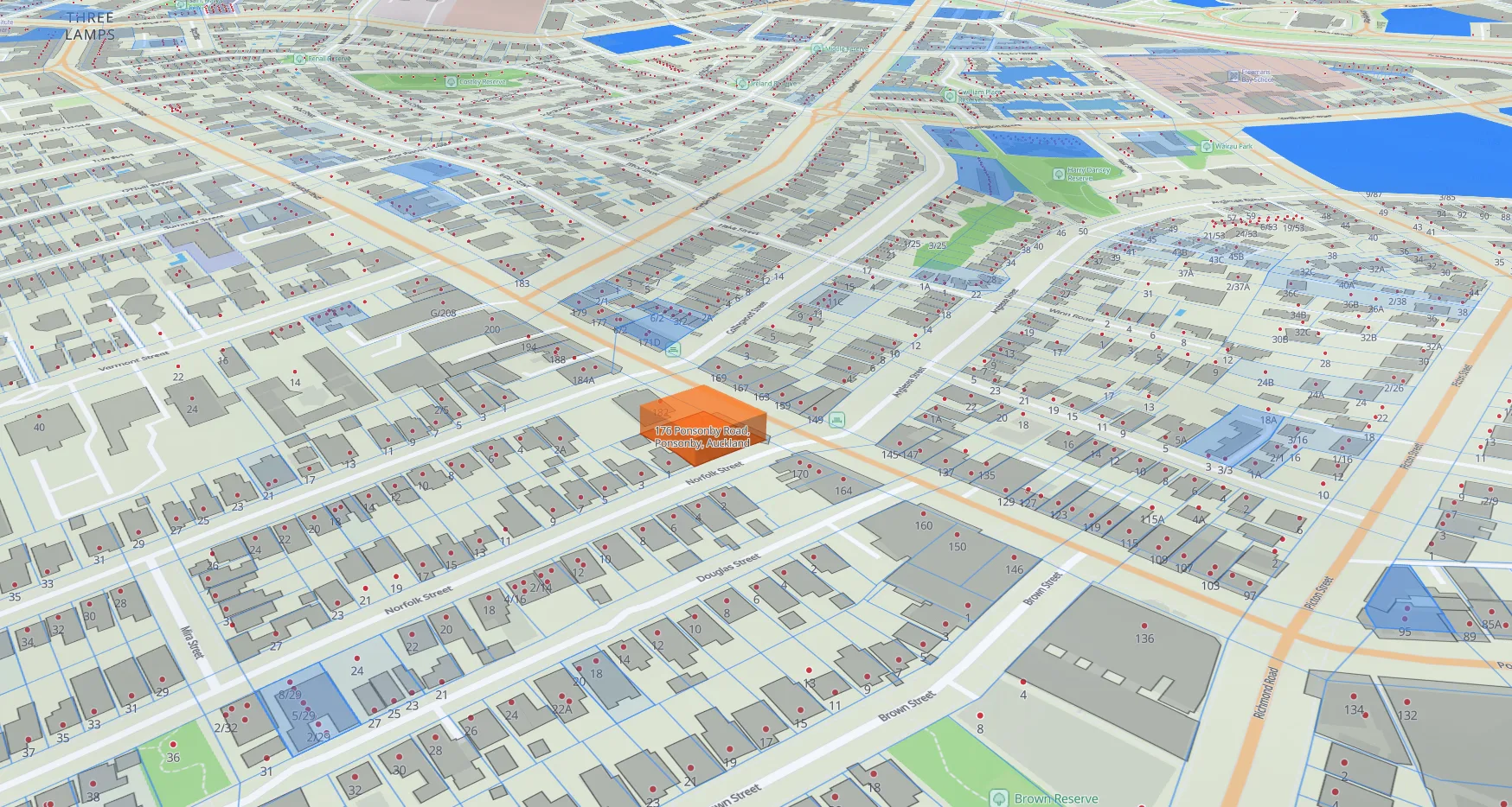
- Marker at 176 Ponsonby Road (highlighted parcel).
- NZ Building Outlines covering the surrounding blocks, extruded to each building's actual roof height and colour-graded from pale pink (~0–6 m) through orange to deep red (60 m+).
One analyst. Every dataset on your map.
Analysis across authoritative data
Building heights, floors, construction, hazard and zoning: answered from the Koordinates Public Data Catalog, with the source cited. Your own private data queried alongside.
Build maps by chat
Add layers, drop markers, style features, extrude buildings in 3D and colour-grade them by height, described in plain English, rendered on the map in front of you.
Built into the map viewer
No assistant to connect, nothing to configure. The Analyst lives in the viewer, sees the layers you have open, and acts on the map directly.
From sign-up to site report in three steps.
Open a map
Start from any dataset in the public NZ catalog, or upload your own. Private data stays private to you.
Ask the Analyst
Open the panel in the viewer and ask in plain English about a place, a layer, or the map you want built.
Get maps and answers
Styled layers, cited answers, and exportable maps come straight back, ready to share or drop into a report.
Ask your data anything.
Control who else can.
Natural-language access to geospatial data through any AI assistant. With enterprise governance: audit trail, access policy, and SSO integration.
outside the 1% AEP floodplain but an overland flow path crosses the eastern boundary.
Prefer your own assistant?
The same engine powers Koordinates MCP. Connect Claude, ChatGPT, or any assistant that supports connections and query the catalog from there: maps, citations, and PDF reports back.
Private data, queried together.
Upload the datasets you work with. They sit alongside the public catalog: visible only to you, joined in the same conversation, never shared.
Included with AI Pro.
The KxAI Map Analyst ships with every AI Pro plan, the single-seat plan for planners, surveyors, analysts, and consultants. No add-on, no upgrade.
AI Pro
For individuals · NZDYour map, with an analyst in it.
Authoritative NZ data, your own data, and a KxAI Map Analyst. One plan.