One place for spatial data.
Self-service for everyone.
Built for AI agents.
Store, browse, and share across your company and clients. People grab what they need — no specialists required. Every dataset is an API. Every dataset is an AI tool.
Built for the teams that need spatial data most
Government & Open Data
Publish, manage, and govern access to authoritative data at national scale. The platform behind LINZ Data Service.
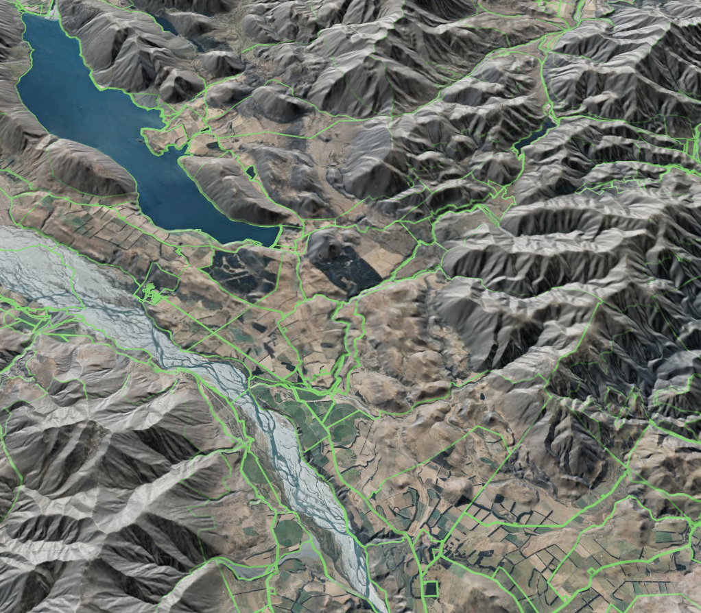
Engineering & Geotechnical
Site intelligence in minutes. Hazard, zoning, and geological data for every assessment — queried by AI or browsed on a map.
Map Application Backend
Cloud storage, auto-provisioned APIs, tile services, and Esri REST endpoints — without running your own GIS infrastructure.
Land Brokerages & Developers
Build a system of record for the properties you broker and develop. Listings, surveys, drone imagery, and the third-party data you ingest — versioned, governed, available to your team.
Ask your data anything.
Control who else can.
Natural-language access to geospatial data through any AI assistant. With enterprise governance — audit trail, access policy, and SSO integration.
outside the 1% AEP
                floodplain
but an overland flow path crosses
the eastern boundary.
Every layer of the geospatial stack,
in one platform.
Cloud storage that scales
Tens of datasets to tens of thousands. Vector layers up to 20GB, raster layers past 2TB — no infra to plan for.
Web-based data management
Import, browse, share, and govern through the browser. Drag-and-drop, Esri REST sync, S3, and SSO (Okta, Azure AD).
Version control for spatial data
Git-style changesets, branches, and merges. QA drafts in private, then publish without breaking live services.
Auto-provisioned APIs
Every dataset is automatically a REST API, an Esri REST endpoint, and an OGC service. Token-managed access.
Map services & tiles
Built-in vector tiles, raster tiles, and Cloud-Optimised Point Cloud previews. In-portal styling, no GIS server.
Formal publishing workflows
Self-service access with permanent URLs, dataset SEO, XML metadata, and nation-scale usage bursts.
 # Git-style version control, for spatial data $ kart checkout -b q1-update
Switched to a new branch 'q1-update' $ kart diff parcels
~ Polygon 47829 (12 Smith St)
 vertices 14 → 16, area +2.3 m² $ kart commit -m "Q1 parcel updates" → 47 changed, 12 added, 3 deleted
Git-style version control,
for spatial data.
Branch, commit, diff, and merge at feature-level granularity. QA changes in private; publish without disrupting the services downstream of your data.
Built on Kart, our open-source distributed VCS for geospatial. Works locally, in the portal, or piped through CI.
Ready to give your team
self-service spatial data?
One place to store, browse, and share with your team and clients. Auto-provisioned APIs included.
No credit card required · Free 30-day trial · Cancel anytime