The data-first GIS platform,
no training required
Save up to 75% on IT & licensesWorks with existing GIS & CAD investmentsBuild map applications without servers
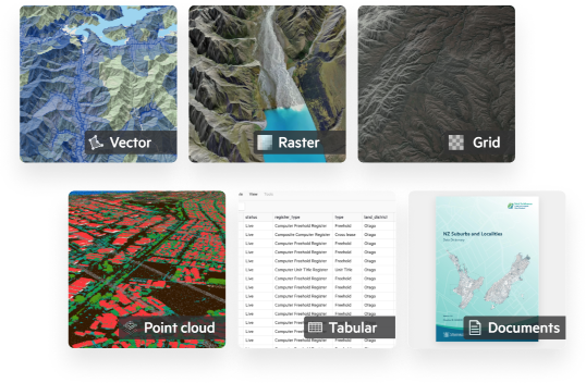
Cloud geospatial storage that scales
- Automatically scale your cloud storage from tens to tens of thousands of datasets – no IT required.
- Support for large datasets, with 20GB for single vector layers and 2TB+ for single raster and point cloud datasets.
- Support for documents, attachments, and XML metadata, automatically linked to datasets.
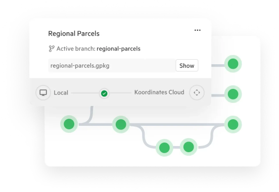
GIS data version control that works
- QA new data with drafts, then publish updates without changing URLs or disrupting services. Users can access updates using Changesets.
- Distributed version control built on git with branches and merges, with revisions made explicit on a preview map.
- Unlike more fragile version control in enterprise GIS, Koordinates version control is robust at scale — with preservation of auditable revisions.
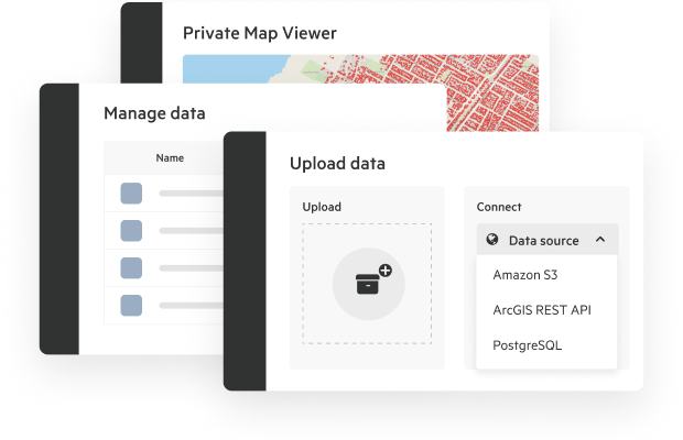
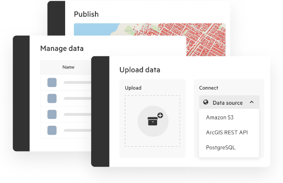
Web-based data management
- Manage your geospatial data assets from a simple web app. No desktop software, APIs, or third-party software required.
- Import data and manage updates from your existing sources, including Esri REST APIs, AWS S3, or drag-and-drop uploads.
- Your data is private by default, and can be shared by project, client, or team. Enterprise SSO supported, including Okta and AzureAD.
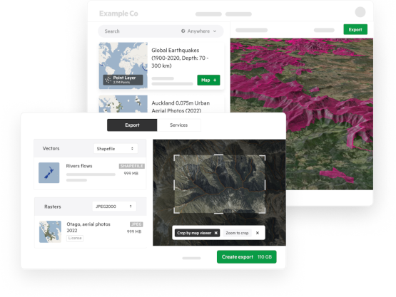
Baked-in data transformation
- Users can export multiple layers at once at their chosen extent, with in-portal queueing, email notifications, and authenticated download URLs.
- Your data is stored in its original coordinate system, and transformed on-the-fly into map previews, APIs, and many different formats and over 5000 coordinate systems.
- APIs and web services are auto-provisioned from your data.
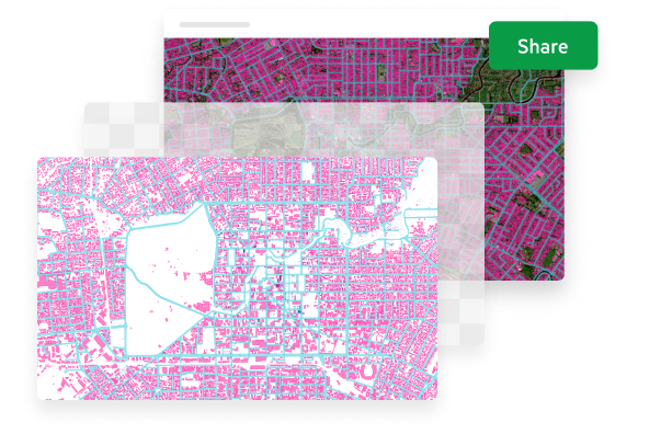
Map services and products for your purpose
- Built-in generation of map tiles and styling for geospatial datasets, including via map API.
- Generate and host map products connected to their source datasets, like Cloud Optimised Point Cloud previews for LiDAR and vector tiles for vector data.
- Create and share Map Viewers with user and client groups, along with their constituent datasets and map products.
3D data portal with Esri REST endpoints
- Your branded portal allows users to view and appraise data on a 3D map — and export it for use in their software.
- Users can automatically translate data — including point cloud — to the formats they need, including DWG for CAD with automatic coordinate transformation.
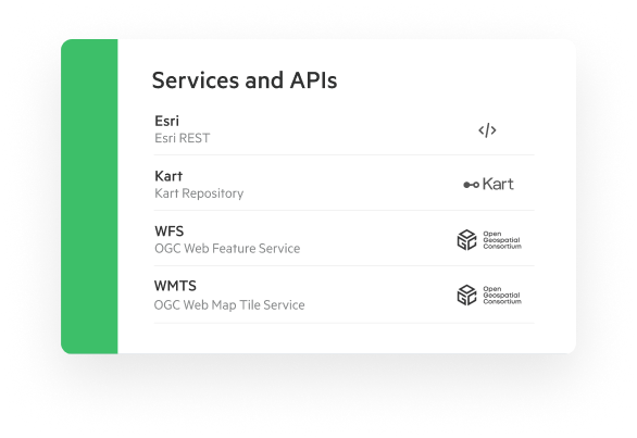
- All data includes agnostic API’s, OGC and Esri REST endpoints and web services out of the box.
Formal data publishing flows and access
- Self-service access to your geospatial data on your own branded portal, with dataset SEO to aid discovery.
- Your portal is engineered to perform during bursts of activity up to nation-state-level usage with no downtime.
- Keep professional users happy with XML metadata, document attachments, and permanent URLs for dataset, web service, and APIs.
APIs, services, and Esri REST endpoints that scale
- APIs are automatically created against every dataset loaded into Koordinates.
- Access to web services and APIs is automatically constrained to access controls.
- APIs and web services are self-service, with users able to manage their own API keys.
Used by geospatial teams from around the world


An enterprise-ready geospatial solution
Koordinates is ISO 27001 compliant, with over a decade's experience in working with enterprise customers in government and the private sector.